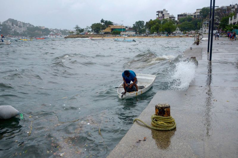
Worry is rising. On Sunday and into early next week, Hurricane Hilary will make a historically uncommon pass across the southwestern United States and sections of California, resulting in the state’s first-ever tropical storm watch.
Parts of California, Nevada, and Arizona could get more than a year’s worth of rain from Hilary. Parts of California are at an extremely high risk for flooding as a result of the danger. This is the first time in Southern California’s history that a threat of this severity has been issued.
On Friday afternoon, the National Hurricane Centre reported that Hilary, a Category 4 hurricane with sustained winds of 145 mph and greater gusts, was churning about 360 miles south of Cabo San Lucas, Mexico.
Over the course of Thursday and Friday, the storm developed from a tropical storm to a Category 4 hurricane, an extraordinary rate of intensification. Even as it nears the Baja California peninsula in Mexico on Saturday, Hilary is expected to maintain its strength as a Category 4 hurricane.
As Hurricane Hilary’s centre moves towards Mexico this weekend, authorities there have issued hurricane and tropical storm watches and warnings for Baja California and the northwest of the country.
As the storm advances north over the next couple of days, there is still a significant margin of error for the greatest winds in the US. Changes in the predicted path of the hurricane could alter the timing and location of the heaviest rainfall and wind gusts.
If Hilary makes landfall in California as a tropical storm, it will be the first such storm to make landfall in California in over 84 years, according to data from the National Oceanic and Atmospheric Administration. Hilary is more likely to make landfall in Mexico and then cross into California.
On Friday morning, the National Hurricane Centre issued a tropical storm watch for sections of Southern California. It covers an area from the southern border of California to Los Angeles County, including all of Orange County.
The hurricane centre stated Thursday night that “the threat of significant wind impacts continues to increase for northern portions of the Baja California Peninsula and the Southwestern United States, especially in areas of mountainous terrain.”
Heavy rains are expected to hit the southwest.
Although Hilary is forecast to weaken somewhat before it makes landfall in Southern California and the Southwest, it will still intensify heavy rainfall and increase flooding risk.
The Southwest is forecast to have heavy rain beginning this Saturday and continuing until early next week, with the worst precipitation likely falling on Sunday and Monday.
It would be difficult to emphasise the significance of the high potential for extreme precipitation. Research from the Weather Prediction Centre finds that days with high risks account for 83% of all flood-related damage and 39% of all flood-related deaths, despite only being issued on average 4% of the time.
Localised amounts of up to 10 inches of rain are possible in the southern parts of California and Nevada. Central regions of those states, along with western Arizona and southwest Utah, should anticipate 1–3 inches of rain.
Climate scientist Daniel Swain from the University of California, Los Angeles, predicted on Wednesday that Hilary may bring “multiple years’ worth of precipitation” to the state’s driest areas.
The hottest site on Earth is located in Death Valley, California, which is on that list. According to NWS measurements, Death Valley sees an average of 2 inches of precipitation each year. Rainfall from Hilary might equal one to two years’ worth in Death Valley in a one day. Also, 2–4 inches of rain are possible in Las Vegas. The annual rainfall averages out to be about 3.75 inches.
Extensive precipitation may cause the ground to become saturated and the waterways to overflow, increasing the risk of flooding.
From San Diego to Los Angeles, homeowners in southern California have been issued flood watches ahead of the weekend.
Threats of extremely high surf, rip currents, and coastal flooding have been issued by the Los Angeles office of the National Weather Service.
The East Pacific is expecting a significant increase in tropical activity in the next days, and the Atlantic is preparing for the same. From west of the Cabo Verde Islands to the Gulf of Mexico, the entire basin is plagued by four distinct regions of concern.
An area in the unusually warm Gulf of Mexico where atmospheric conditions potentially come together to encourage tropical development next week is of most urgent concern to the United States. By midweek, a low pressure region may have formed in the basin, grown in size, and taken on tropical features over the western Gulf.
The tropical Atlantic features three distinct trouble spots. West of the Cabo Verde Islands, a patch of disorganised showers and thunderstorms may develop into a tropical depression this weekend, with the potential to grow into a tropical storm by next week. A second area of turbulence to the west has the potential to develop into a tropical depression by the start of next week. Another region near the Lesser Antilles is unlikely to get tropical weather.


